1

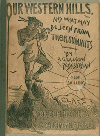
Our Western Hills: How to reach them; And the Views from their Summits By a Glasgow Pedestrian — Key Ideas to Explore
(0 User reviews)
354
Project Gutenberg
2020
Not confirmed
Scotland -- Description and travel; Hiking -- Scotland
Readers of public-domain and historical texts
Project Gutenberg digital edition
en
Edition facts
Words
40,017
Reading time
174 min
Text sections
20
This digital edition of Our Western Hills: How to reach them; And the Views from their Summits By a Glasgow Pedestrian — Key Ideas to Explore is described by source-level measurements including 40,017 words, 2 hr 54 min estimated reading time, and 20 detected text sections.
The text analysis averages about 29.5 words per sentence, while the detected sections provide another way to judge how the source is divided.
Project Gutenberg metadata also associates the work with “Scotland -- Description and travel,” connecting these edition facts with the source record’s subject description.
Source:
Project Gutenberg record #62811
An 1892 walking guide to Scotland's western hills, blending practical route advice with observations on geology, botany, and literary associations, written by a Glasgow pedestrian.
Editorial Edition Score
4.8/5
★★★★★
★★★★★
Calculated from edition completeness, EPUB availability, text structure and catalogue metadata. Not a user rating.
How this score is calculated
- Description quality20 pts
- Title & short description10 pts
- Source metadata20 pts
- Text length15 pts
- Chapters / structure15 pts
- EPUB file integrity20 pts
Total of 100 points, scaled to a 2.5-5.0 range. Editions with an empty description or a missing EPUB file are not scored.
Edition quality
Read the Text
h, in his book on Strathblane, has acted the part of an “Old Mortality” in this one.
The Spout is a cascade of 70 feet formed by the Blane in its passage to the valley below, and which, with its surroundings of rock and wood, presents a scene of the most wild and romantic beauty; the hollow into which the river plunges being filled up with a vast collection of gigantic stones piled upon each other, and adorned on its sides with many alternate strata of various hues.
Anyone can see for himself at a glance at Ballagan the process by which our mountain glens and gorges are formed—how after a heavy rainfall the descending waters rush down the watercourses, setting all the boulder and rock fragments in the bed of the stream in motion. The last of the old race of the Levenax, or Lennox, had a castle near to and in sight of this romantic glen, from which fact the range of hills was, and frequently still is, called the Lennox range, and its highest point the Earl’s Seat. Ballagan House, which is close at hand, commands a beautiful view of the fall, and is within hearing of its music, even when it has not the power to strike a loud note. In flood-time the Spout is stupendous, and increases its apparent height by covering the huge masses below so as to vie with the sublimity if not the beauty of Cora Linn. This may seem to some to be rather strong language, but all measurement is comparative, and it may be possible to feel that there is more than prettiness or even grandeur here.
The view, even half way up, is not to be despised, the beauty of which consists in its “breadth,” as an artist would say. The meadows, with their green frames of hedges, may be compared to small cabinet pictures—lovely, but small. This is life-like—a broad cartoon from the hand of nature. The sward rises and rolls along in undulations like the slow heave of an ocean wave. Handsome trees of all sorts are scattered around, under whose ample shade cattle can, and, to judge from the brown and bare patches around their trunks, evidently do, repose in the heat of the day. Following up the stream, which in its higher reach is called the Laggan Burn, we come on two smaller cascades, and after a pleasant and comparatively easy ascent up the fretted terraces of trap, reach the summit, 1894 feet above the sea level, 3 miles to the north of the station we have left, and at the meeting point of Killearn, Campsie, and Strathblane parishes.
The climb to the top will well repay a visit, as will readily be believed when we say that the eye embraces a range of scenery extending all the way from Ben Lomond to Tinto. The prospect before us is of the most beautiful description; the vast basin of the Clyde from Kilpatrick to Dechmont lying stretched at our feet, with Glasgow, Paisley, and many other towns and villages scattered on its breast; while the line of the horizon is formed by the Gleniffer, Fereneze, and Cathkin braes. Immediately below us is the valley of the Blane, or Warm River; and we cannot help acknowledging that Strathblane (the valley of the Warm River) is a word that is peculiarly descriptive of the valley, which is sheltered in almost every direction from the violence of the winds. The probability is that, with part of Campsie (the crooked strath, according to some), it was at some long-past date a fresh-water loch, and that subsequently the barriers in the direction of Loch Lomond were broken down, and the valley drained accordingly. The nature of the soil contributes to establish this opinion, consisting largely of sand, gravel, and other comminuted fragments of the neighbouring rocks. The valley of the Blane, as it winds its way westward from the bare and desolate conical hill of Dunglass, 400 feet high, on the east, to the conical and finely wooded hill of Dunquaich, on the west, also 400 feet high, is one of the prettiest in Scotland, quite equal to and not unlike the drive between Crieff and St. Fillans, which Dr. John Brown, in his “Horæ Subsecivæ,” calls the finest 13 miles in Scotland.
This 1892 guidebook, written by an anonymous Glasgow pedestrian, offers detailed walking routes to the summits of Scotland's western hills, with a focus on practical access from the city. The author explicitly states the book 'make[s] no pretence to fine writing or original matter,' instead aiming to be 'a short and, I trust, readable guide' for those with 'average physical endurance.' The dedication to James R. Manners frames hill-climbing as a healthy pursuit for 'our working bees'—a phrase borrowed from Dr. Andrew Wynter—and the text balances route descriptions with notes on geology, botany, and literary associations, particularly with Sir Walter Scott.
Practical Directions and Local Knowledge
The guide is notably specific about access points and costs. For Ben Venue, the author advises leaving the coach road at Achray House, passing through the offices of Mr. Thomson, and following a burn until a clump of birch trees marks the start of the climb. He notes that the coach 'has to walk the half of the way' but that a ride costs 'six shillings' via a new road made by 'his Grace of Montrose.' The author also mentions the slate quarries near the summit, which give 'employment to about 100 men,' and the sluice between Loch Katrine and its overflow, remarking that the flow is 'not now so large as before we in Glasgow began to make such a pull on Loch Katrine.' These details root the guide in the specific infrastructure and economy of the late 19th century.
Botanical and Geological Observations
Alongside route instructions, the author includes precise natural history notes. On the ascent of Ben Venue, he lists plants that may be gathered: 'Burnet saxifrage, moneywort, and marjoram; also, of the juniper and yew, the fruit of the latter being exceedingly beautiful with its bright red waxen cup holding the seed.' He also describes the summit approach as 'something like the burying-place of giants,' covered with 'ladies mantles.' The height of Ben Venue is given as '2393 feet above the sea level,' and the author notes that the ascent can be made in 'two and a half hours,' though he once did it in 'an hour and forty-five minutes' without a rest, which he 'could not advise anyone to repeat.'
Literary and Scenic Framing
The author frequently invokes Sir Walter Scott's descriptions of the Trossachs, calling the scenery 'world-famed' and noting that Scott 'immortalised' the district. He quotes the phrase that the scenery 'beggars all description,' calling it 'more forcible than elegant,' and asserts that Scott's descriptions 'do no more than justice to the original.' The guide also contrasts Scottish hills with the Alps, stating that while 'we certainly miss at home the solemn and almost unearthly look of the Alps,' Scottish hills have 'greater variety in colour, size, and shape' and 'historical and antiquarian associations.' This framing positions the hills as both a natural and cultural landscape, accessible to the ordinary walker.
Readers should note that this guide reflects the transport and social conditions of 1892, with references to coach roads, private estates, and Glasgow's water supply. The author's voice is practical and occasionally wry, as when he advises against repeating his own fast ascent. The book is best used as a period piece and a starting point for exploring these hills, rather than as a modern route guide, since paths and access may have changed.
There’s something tender about old guidebooks, how they assume you’ll walk slowly enough to notice a fern’s particular green. That Glasgow pedestrian’s hills feel like old friends now. Fancying the same unhurried longings, I sometimes open that other volume, Travels in Central Asia Being the Account of a Journey from Teheran Across the Turkoman Desert on the Eastern Shore of the Caspian to Khiva, Bokhara, and Samarcand — Key Ideas to Explore, and imagine horizons equally patient, equally vast.
There are no reviews for this eBook.
There are no comments for this eBook.
Reader reflection
How did this book work for you?
Your answers remain private and are stored only in this browser.
Your progress
0
/
10
2
How did the book work for you overall?
3
Is this a title you would suggest to others?
4
How demanding did the text feel?
5
Was the book moving at the right speed?
6
Did any part of the book stay with you emotionally?
7
Did the book deliver what you hoped for?
8
Could you follow the author’s main argument?
9
In one sentence, what did you learn?
10